K4: HISTORY OF MEANS OF TRANSPORT IN THE VRHNIKA AREA
A trip into the history of transport while experiencing the marshes
Path recap
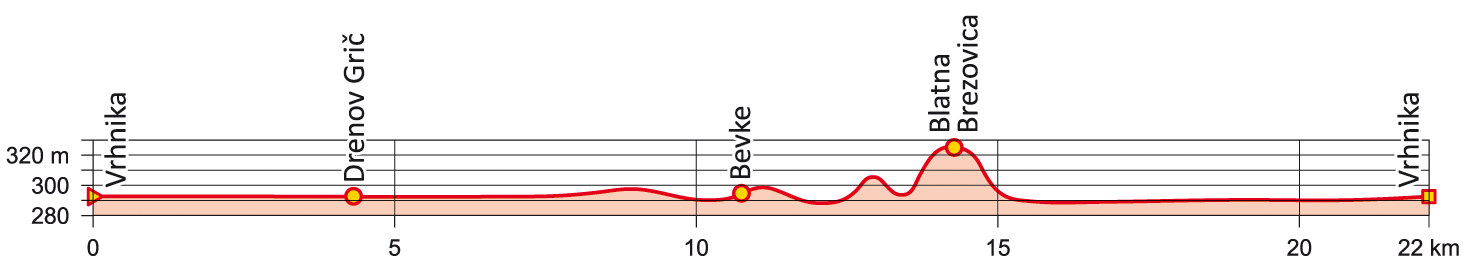
Follow the traces of five millennia of transport and routes in the hinterland of Ljubljana - from the world's oldest discovered bicycle to the first stretch of motorway in Slovenia and the former Yugoslavia! You can read about the history of transport on the explanatory boards along the way, and enjoy a pleasant cycling loop along the beautifully landscaped abandoned railway line and the vast world of the Ljubljana Marshes. The ride is mostly flat with only two steep but short climbs to get the heart rate up.
Detailed path description
You will cycle along the K4 route, which is part of the Vrhnika Cycling Route Network. This means that you will be guided by route signposts most of the way.
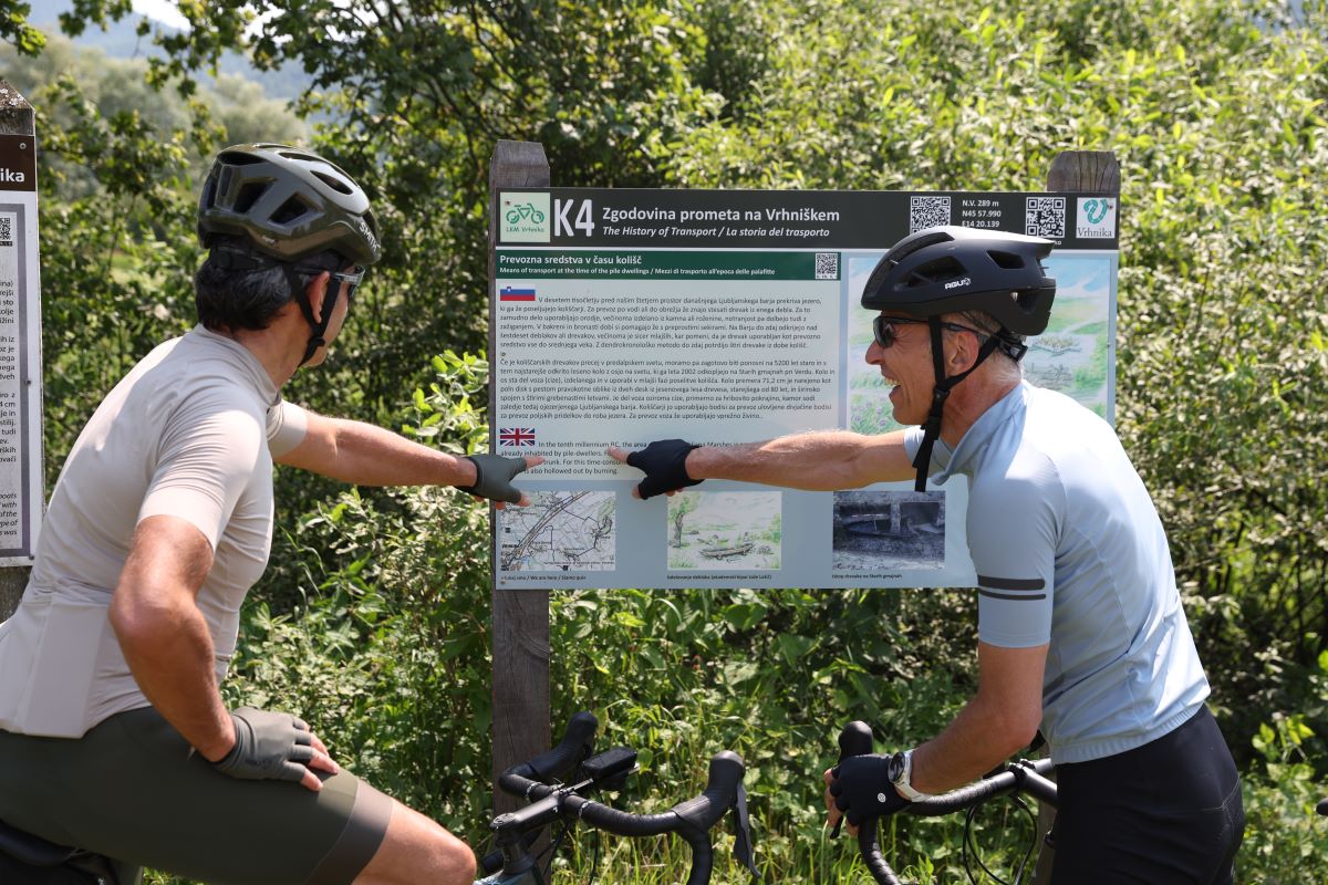
The start (and end) of the loop route is the railway station of the last section of the iron road in Vrhnika, which connected Cankar’s hometown and Ljubljana but has been abandoned for a decade. Here, you will find an explanatory trailhead board telling you about the history of transport in Vrhnika and getting you started on your way.
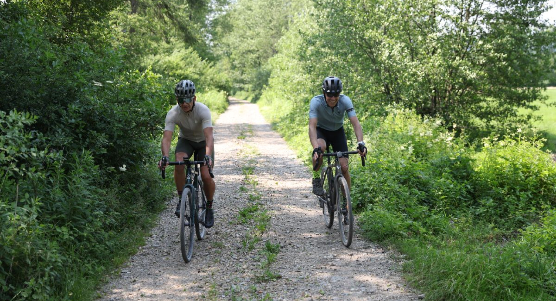
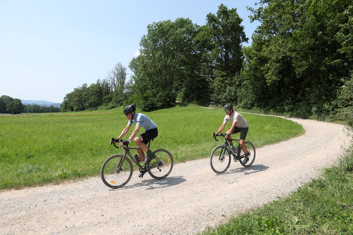
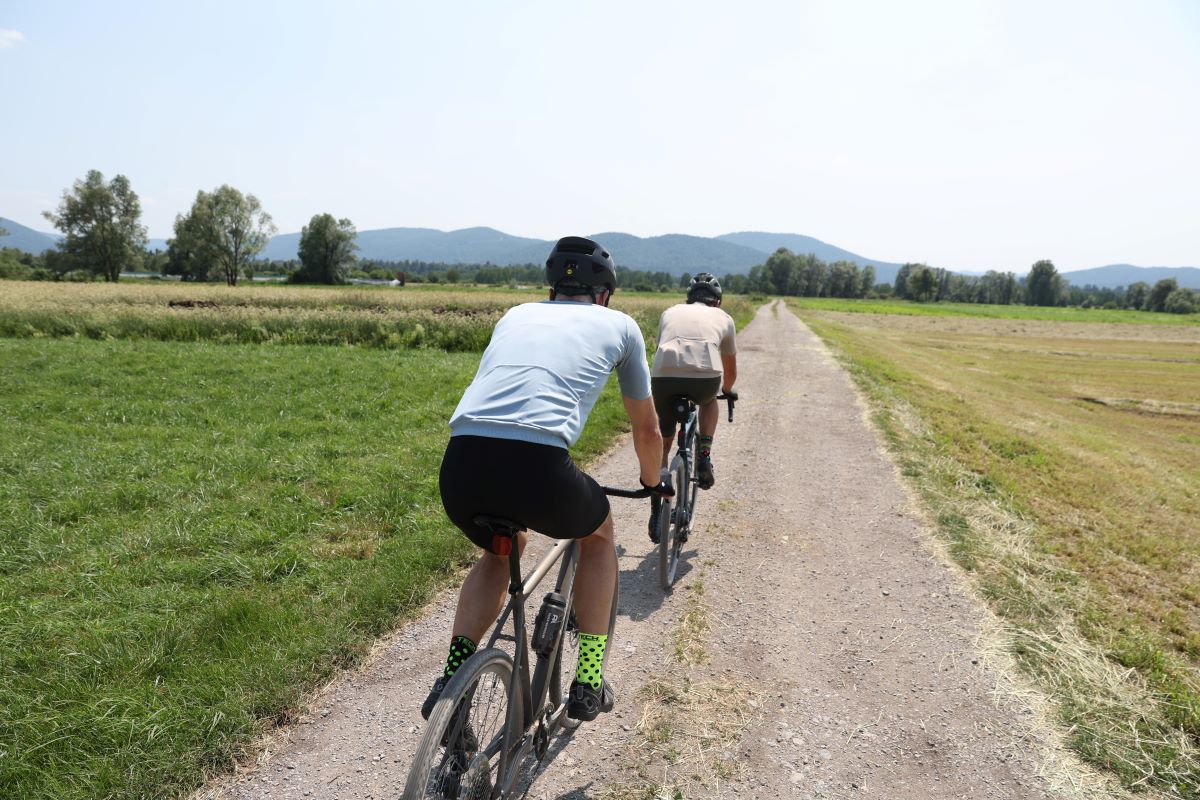
The trail initially follows the former railway line that has been turned into a pleasant gravel path; a tree avenue with beautiful views of the green landscape on the left.
The route goes straight up to the village of Drenov Grič and then onwards until it leads you to the Vrhnika-Ljubljana road, which you can safely cross and then continue on a quiet asphalt road towards the village of Bevke on the Ljubljana Marshes. Please note: this part of the route is the only section where the signposts disappear, so check a map or GPX track carefully!
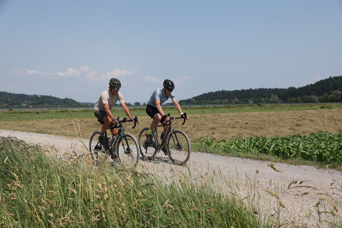
The rest of the route leads through the marshes, among vast grassy plains and sparse forest and past water ditches typical of the marsh landscape. It takes you through Bevke (stop by the former village scales or weigh station and see if it detects a "load" as light as a man!) and the isolated Blatna Brezovica, where the route overlaps with the thematic Beaver Learning Trail. At this point, you will have to negotiate the only two (short) climbs on the way. The second one leads to St. James Church and "flattens out" abruptly into a scenic route – behind you the Krim hills rise above the marshes, and the Polhov Gradec Dolomites open up in front of you with a backdrop of the Alps.
The route proceeds mainly on quiet asphalt and comfortable gravel roads. Even though you are often close to major roads, you are sheltered in a cocoon of tranquillity most of the way.
The route has signposts and explanatory boards for most of the way, but you will need to use a map or GPX track to find your way through some sections.
Vrhnika, former railway station at the junction of Jelovškova cesta and Delavsko naselje; an explanatory trailhead board marks the start of the route.
Free parking is available on Tržaška cesta in front of the Vrhnika Tourist Information Centre (TIC), just before the trailhead.
Take the Ljubljana city bus (LPP) from Ljubljana to Vrhnika, line no. 47.
Hospitality establishments in Vrhnika
Bevke Sports Park
Ivan Cankar memorial house (Cankarjeva spominska hiša)
Technical Museum of Slovenia (Tehniški muzej Slovenije) in Bistra
Mali Plac Nature Reserve, Bevke
The Marsh Pixies Trail to Mali Plac (Pot močvirskih škratov na Mali plac), Bevke
Village scales (Vaška vaga), Bevke


